

Geodetic Support of Pipeline Construction: The Full Cycle
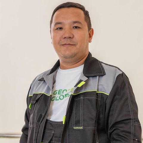
Makhmud Ukibayev
Head of Engineering Surveys Department
Geodetic support of pipeline construction is not a one-off visit “to look at the route”. It is an end-to-end cycle from the pre-design corridor survey to the as-built drawing of the laid pipe before backfill. If the surveyor appears only at acceptance, the actual axis, depth and welds are already under soil. On oil and gas corridors in Mangystau Region the cost of that error is relaying kilometres of pipe and a failed handover of the linear asset.
This article is for operators’ and EPC technical staff: which works sit in the full cycle, in what order they run, and which documents stay with the client.
What the Full Cycle Contains
A linear asset lives longer than a pad: the route crosses scarps (chinks), sors, roads, third-party utilities and buffer zones. Surveying holds one coordinate system from corridor selection through as-built documentation.
| Stage | Survey works | Client deliverable |
|---|---|---|
| Pre-design | Corridor topo, long section, DTM | Route choice, earthworks volumes |
| Design | Setting-out network, chainage catalogue | Data for the design package |
| Construction | Axis and bend setting-out, trench control | Setting-out acts, field log |
| Before backfill | As-built of pipe, fittings, crossings | As-built of concealed works |
| Handover | Combined as-built plan, deviation list | Pack for technical supervision and mine survey |
| Operation | Monitoring of supports, racks, subsidence zones | Deformation cycles |
The wider set of oil and gas survey tasks is in the guide to geodetic surveys for oil and gas. Pipeline support is the linear stream inside that scheme.
Pre-design: a Corridor, Not a Point
Route selection needs a strip, not chainage every 100 m. For 5–50 km corridors in Mangystau, UAV aerial photography with a DJI Matrice 4E and ground GCPs tied by South GNSS / Leica GS-08 Plus to the state network closes area faster. The Leica TS06 Plus total station stays on tight sites: crossings, crane pads, tie-ins to gathering stations and gas-distribution points.
Typical pre-design scales are 1:2000 / 1:5000, with a long section at the interval set in the brief. On Mangystau scarps and salt domes a “smooth” route on a 1:25 000 map often breaks in the field: gradient, scarp brink, sors. A DTM shows that before an impossible cut volume is written into the estimate.
When a drone beats a ground crew — in the comparison of UAV versus conventional surveying.
Setting-out and Trench Control
Setting-out transfers the design axis, bend points, chainage and trench-invert levels onto the ground. Marks are fixed so the excavator does not wipe them on day one: offset lines, extra benchmarks outside the right-of-way.
During construction control follows the as-built:
- Axis and chainage — plan agreement with the design.
- Invert level — gradient, cover, bedding.
- Bend radii — actual geometry before lowering-in.
- Crossings — position of existing utilities, confirmed with a Vivax Metrotech locator and as-built of opened sections.
Plan and height tolerances come from the design and the operator’s internal standard. The surveyor records deviations immediately: after backfill they cannot be measured directly. As-built of linear networks is a distinct work type; the logic matches as-built survey in construction, but the object is a pipe in a trench, not a building.
As-built Before Backfill
This is a mandatory gate. The crew surveys:
- actual axis and top-of-pipe levels;
- welds and fittings (valves, vents, supports);
- casings at road crossings;
- ties to permanent ground features and to the site control network.
Deliverable formats are DWG and PDF as-built drawings, a coordinate catalogue, a deviation schedule, and materials for the concealed-works act. Without this pack, technical supervision will not sign trench closure.
On remote stretches at Zhanaozen, Beyneu and the Buzachi Peninsula the crew works from its own control: SGN marks are often destroyed or inaccessible, so the tie is static GNSS sessions with long baselines.
Documents and Accountability
The client does not receive “a route plan”. They receive a traceable pack: setting-out drawings, field logs, as-built drawings, an accuracy statement. Work is done with verified instruments (Leica TS06 Plus, South G4 GNSS / Leica GS-08 Plus). The regulatory frame is the Law of the Republic of Kazakhstan on Geodesy, Cartography and Spatial Data and SP RK 1.02-101-2014 on engineering-geodetic surveys; the as-built composition is also set by the operator contract.
A surveyor on the spread full-time or visits on a schedule are two working models. The service is described on the construction survey support page.
FAQ
Can the pipe be surveyed after backfill? Partly — with a locator and at chambers. Actual weld geometry and cover along the whole string cannot be recovered that way. Pre-backfill survey is not optional.
Does the whole corridor need one coordinate system? Yes. A join of “pad in the site CRS / route in WGS with no transformation keys” breaks the as-built at gathering-station boundaries.
How long does support last? From mobilisation to the first chainage through the final as-built plan. A duty-surveyor contract is agreed case by case, typically from a month of active lowering-in.
Conclusion
The full pipeline survey cycle is corridor, setting-out, trench control, as-built before backfill, and the handover pack. Skipping any link leaves concealed works without coordinates.
GeoProGlobal supports linear assets in Aktau, Zhanaozen, Beyneu and across Mangystau Region: ground survey, GNSS ties and corridor aerial photography. To discuss a brief for your section of route, submit a request on the quote page.
Need a consultation for your site?
Send the brief or call us and we will return a preliminary site estimate within 24 hours.